Mapping The White (Day After) Christmas
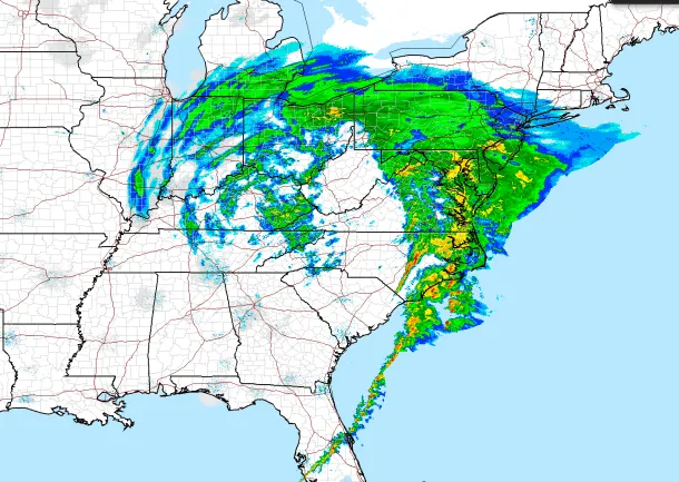
Here in D.C. we woke today to a surprise coat of snow/sleet, the first significant wintry mix of the season. Apparently, the precipitation came from a massive storm that's dumped rain and snow — and sparked tornados — over a large swath of the country. The National Weather Service has a fancy (and new to me) radar map that shows the storms size and intensity. Check it out:
[caption id="attachment_1262" align="alignnone" width="620"] National Weather Service[/caption]
[Via my colleague, Mark Memmott]