Mapping 'Rich Blocks, Poor Blocks'
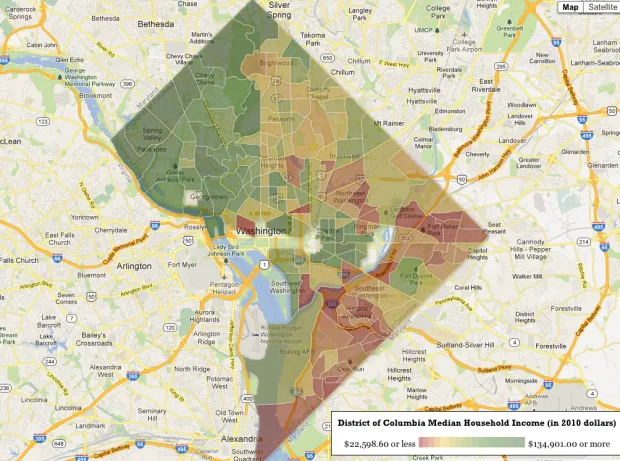
"Rich Blocks, Poor Blocks" allows users to get information about income in their neighborhoods, using the 2006-2010 American Community Survey estimates* compiled by the U.S. Census Bureau. Here's a map of Washington, D.C., which — as I've noted before — is segregated by race, educational attainment and income:
[caption id="attachment_1271" align="alignnone" width="620"] Source: Rich Blocks, Small Blocks[/caption]
* These data have high margins of error in small geographic units like Census tracts, which this service uses, so don't take the figures literally. Still, the estimates can be useful for spotting broader trends about communities.
Thanks to the wife for sharing this discovery.