Mapping D.C. Building Heights
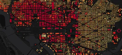
I posted yesterday about residential buildings in Seoul and South Korea. Here's a quick look at the buildings in my previous city, Washington, D.C. Darker shades represent taller buildings:
I posted yesterday about residential buildings in Seoul and South Korea. Here's a quick look at the buildings in my previous city, Washington, D.C. Darker shades represent taller buildings: