Posts tagged "gis"
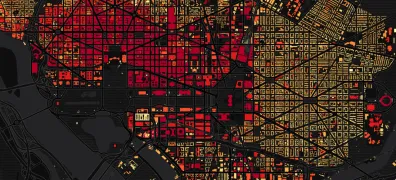
Mapping D.C. Building Heights
I posted yesterday about residential buildings in Seoul and South Korea. Here's a quick look at the buildings in my previous city, Washington, D.C. Darker shades represent taller buildings:
Read more →
Mapping Clinton, Trump Support
I've been collecting county-level data on the presidential primary race since the contests began earlier this year. With Donald Trump now the Republicans' presumptive nominee — and Hillary Clinton rapidly...
Read more →
Mapping 2011 Earthquakes
This 2011 earthquakes map, rendered in Google Earth, shows just how rare seismic events are on the East Coast: View larger version UPDATE: Adding historical data I discover… This map...
Read more →
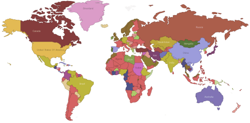
How the World is Governed
This interactive map, created by Many Eyes user Vortextual, categorizes government regime types by country, according to the CIA World Factbook:
Source: Download Data
Read more →